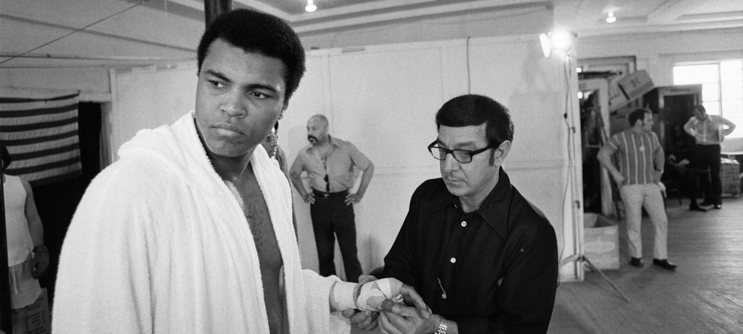
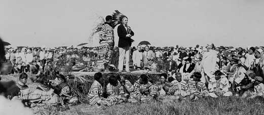
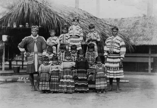
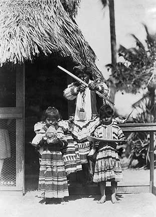
HistoryMiami Museum

Homepage

  • Explore
    • Collecting 2020 Initiative
    • 10 Days of Connection 2020
    • HMM On Demand
    • Hands on History
    • Exhibitions
      • Current
      • Upcoming
      • Past
      • Online Exhibitions
    • Collections
    • Education Center
      • City Tours
      • Youth Field Trips
    • South Florida Folklife Center
    • Center for Photography
    • Research Center
    • Miami Stories
    • Community Gallery – The Adventures of Bibi and Friends
  • Programs & Events
    • Calendar
    • Upcoming Events
    • FREE Family Fun Days
    • CultureFest 305 2021
    • 2022 Miami International Map Fair-CANCELED
    • Members Only Event: 13th Annual Presidential Symposium
    • Summer Passport Program
    • Via Zoom! In Class with Dr. George: South Florida’s Communities
  • Tours
    • Private City Tours
    • Public City Tours
    • Weekend Gallery Tours
    • Adult Groups
    • Youth Field Trips
  • Join & Support
    • Become a Member
    • Corporate Sponsorship
    • Support HistoryMiami Museum
    • Volunteer Opportunities
  • Research
    • Research Center
    • Online Publications
    • Collections
    • Video Channel
  • Rentals
    • Corporate & Non-Profit
    • Weddings & Special Occasions
    • Photo, Film, & TV
  • About
    • About the Museum
    • Accessibility
    • Staff
    • Board of Trustees
    • Careers & Opportunities
    • Hours & Admissions
    • Map
    • Press Room

The Everglades Exploitation & Conservation

The Everglades Exploitation & Conservation

  • Indians
  • Drainage
  • Small Farms
  • Royal Palm State Park
  • Exploration
  • Flood Control
  • Lower Everglades Settlements
  • Sugar
  • Everglades National Park
  • Roads
  • Endangered Species
  • Big Cypress National Preserve
  • Tourism
  • Everglades Restoration
  • Upper Everglades Settlements
Elite Photo Concern.  Man gazing upon Everglades pinelands, southwest of Royal Palm State Park. ca. 1920.  X-768-4

Full Image

Matlack, Claude C.  Seminole poling past land reclamation billboard (Tamiami Canal, Fla.). March 27, 1920.  5-30 Matlack

Full Image

INDIANS

Everglades Indians


The ancestors of today's Seminole and Miccosukee Indians moved into the South Florida interior during the early decades of the nineteenth century. They lived on remote tree islands throughout the Everglades and Big Cypress Swamp, and had little contact with the outside world.

Beginning in the 1910s, tourist attractions brought them into contact with non-Indians and provided financial support while helping preserve their culture. Beginning in the 1930s, many, but not all, moved to reservations. The Seminole Tribe organized in 1957 and the Miccosukee Tribe in 1961.
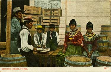
During the second half of the century, white settlers established trading posts, where Seminoles bartered alligator hides, pelts and bird feathers for cloth, beads, and sewing machines.  Postcard, ca. 1900. 1984-100-23

Full Image

“Forward to the Soil,” a 1927 ceremony near Hialeah, celebrated land reclamation. This publicity stunt included a “peace treaty” with the Seminoles. Fearing a loss of sovereignty, alarmed tribal leaders reiterated their independence for years and emphasized that no official treaty had ever been signed.  Photo by Claude Matlack. 101-30.

Full Image

Seminoles traveled by dugout canoe from their homes in the Everglades to trading posts on the coast. They sold animal skins and feathers, and bought store goods, such as umbrellas, hats, and coffee pots.  HMSF, gift of Elizabeth Gardner. 1997-505-1.

Full Image

Beginning in the 1910s, Seminoles and Miccosukees divided their time between tourist attraction villages and secluded camps on tree islands in the Everglades and Big Cypress Swamp. This photograph was probably shot at Musa Isle, on the Miami River.  December 11, 1923.  Photo by Claude Matlack. 90-30

Full Image

Some Miccosukees moved their homes and villages to Tamiami Trail, where they earned a living through tourism.  HMSF, Miami News Collection. 1989-011-13309.

DRAINAGE

The Swamp Land Act of 1850 transferred wetlands from the federal government to the states. Florida gave most of its submerged land to railroad companies and other developers in exchange for drainage projects and railroad construction.  Cartoon from

Full Image

Once exposed to air, the muck dried, slowly oxidized, and shrank. In this 1951 photo Dr. Victor Green shows 25 years of subsidence at the Everglades Experiment Station.  1996-047-431-1070

Full Image

Land reclamation was more difficult than anyone had anticipated. Some canals did not drain the adjoining land, and lateral drainage ditches had to be dug as well.  This view shows a Buckeye open ditcher digging a ditch running parallel to canal on the Davie agricultural farm. 1913?  1976-051-20

Full Image

In 1906 the dredge Everglades began digging a canal from the New River (Ft. Lauderdale) to Lake Okeechobee. Other canals soon followed: North New River, South New River, Miami, Hillsboro, and Caloosahatchee.

Full Image

Dredge on the Miami Canal. 1911?

Full Image

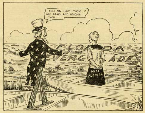
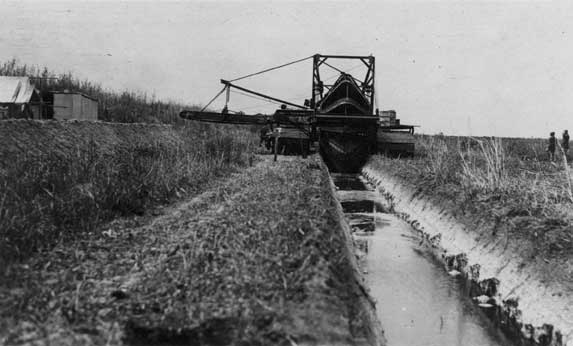
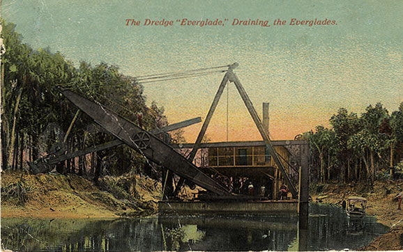
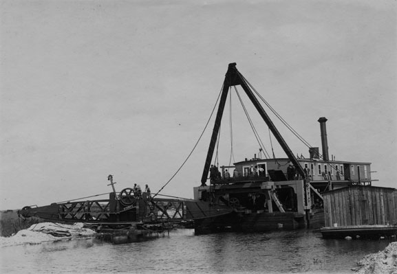
During the late nineteenth and early twentieth centuries, many people believed that South Florida's wetlands could be drained simply by digging canals, and that the new, dry land would be remarkably fertile.

For them, progress consisted of draining "swamps" and creating dry land that could then be farmed and built upon.

SMALL FARMS

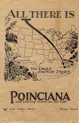
Beginning in the early twentieth century, companies connected with drainage projects sold land to individuals for small truck farms. (A truck farm produces fruit and vegetables, which are trucked to city groceries.)

Much of the land was un-surveyed wetlands, which gave Florida realtors the reputation of selling "land by the gallon." Most purchasers never saw their land, but many others made a go of it. Everglades farming proved more difficult than anticipated, and few made a living as small farmers.

The Model Land Company managed the lands acquired by the Florida East Coast Railway, and sold land for small farms. It promoted agriculture through the annual Dade County Fair. This display attracted attention at the 1898 fair.  1987-227-10

Full Image

Everglade Land Sales Company salesmen show the Everglades and reclaimed land to prospective buyers. ca. 1911.  1976-051-127

Full Image

Crops planted on reclaimed land sprouted and grew vigorously, only to wither and die for lack of trace minerals.  Sugar cane field, ca. 1912.  1976-089-2

Full Image

From the 1920s to the 1940s, companies bought up and consolidated small farms around the southern side of Lake Okeechobee. These large farms grew vegetables or sugar, and in time became profitable.  Vegetable crate label.  1991-370-8

Full Image

From the 1920s to the 1940s, companies bought up and consolidated small farms around the southern side of Lake Okeechobee. These large farms grew vegetables or sugar, and in time became profitable.  Vegetable crate label.  1991-370-2

Full Image

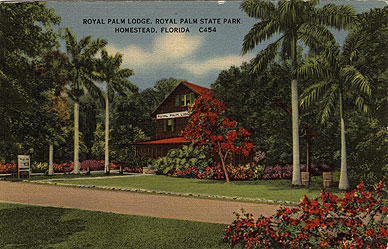
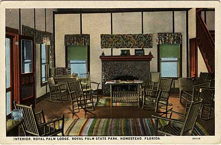
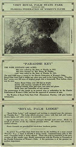
ROYAL PALM STATE PARK

The Florida Federation of Women's Clubs established Royal Palm State Park in 1916, on land donated by the Model Land Company and purchased by the Federation.

The park protected Paradise Key (including present-day Anhinga and Gumbo Limbo trails in Everglades National Park), a large hardwood hammock containing many Royal Palms. In the 1940s, the Federation gave the land to the federal government, and it became part of Everglades National Park.
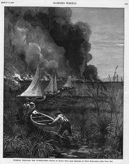
Royal Palm Lodge, 1930s  1985-052-2

Full Image

Royal Palm Lodge. 1920.  HMSF, Claude Matlack Collection. 9-50.

Full Image

Royal Palm Lodge, 1920s.

Full Image

Royal Palm State Park flyer. 1921?

Full Image

“Orchids of Paradise Key.” Plate from Natural History of Paradise Key and the near-by Everglades of Florida. 1919.

EXPLORATION

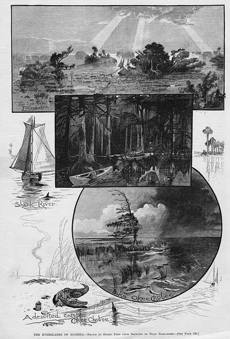
Few people other than Indians ventured into South Florida's interior during the nineteenth century; and the land, consequently, was mysterious, unknown, and misunderstood.

A series of expeditions gradually revealed the nature of the Everglades to civilization.


Read A. P. Williams’ report: part 1 and part 2
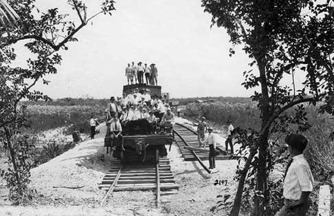
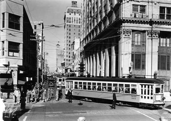
Hunters on Coot Bay, by J. K. Small. April 1916.  HMSF, Charles Torrey Simpson Collection, X-763-15.

Full Image

The New Orleans Times-Democrat sponsored an expedition in 1883 that traveled from Lake Okeechobee to the head of Shark River. A. P. Williams led this search for land suitable to drain and develop for agriculture.  “Pushing through the Everglades,” drawn by Harry Fenn from sketches by Wolf Harlander. Illustration for “Glimpses of The Everglades,” by William Hosea Ballou. Harper's Weekly (March 12, 1887), p. 181.

Full Image

Tamiami Trail survey crew. Tamiami Trail develop James F. Jaudon is second from the left. early 1920s.  X-055-146

Full Image

The New Orleans Times-Democrat sponsored an expedition in 1883 that traveled from Lake Okeechobee to the head of Shark River. A. P. Williams led this search for land suitable to drain and develop for agriculture.  “The Everglades of Florida,” drawn by Harry Fenn from sketches by Wolf Harlander. Illustration for “Glimpses of The Everglades,” by William Hosea Ballou. Harper's Weekly (March 12, 1887), p. 180.  1984-95-2.

Full Image

EVERGLADES ROADS

The Model Land Company built Ingraham Highway from Florida City through Royal Palm State Park to Flamingo in 1916-1922. The rock/mud road was nearly impassable until the Park Service rerouted and rebuilt it after 1947.  Ingraham Highway, 1929.  HMSF, Claude Matlack Collection. 151-50

Full Image

A dredge dug fill for the Tamiami Trail roadbed, and dug Tamiami Canal. This photo shows, from front to back, a service boat, drill barge, and dredge in Tamiami Canal, 1926 or 1927. The dredge and roadbed became an unintentional dam, impeding the flow of water from the north to the south.  X-1311-1

Full Image

Alligator Alley-the second road to cross the Everglades-opened in 1968. Like Tamiami Trail, it was built from both ends to center, was costly and difficult to build, and was promoted as a stimulus to economic development. Soon, however, the newly created Big Cypress National Preserve protected much of the lands surrounding it from development. Instead of farms and developments, bridges and culverts were added to protect wildlife and improve north-south water flow.

Full Image

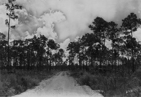
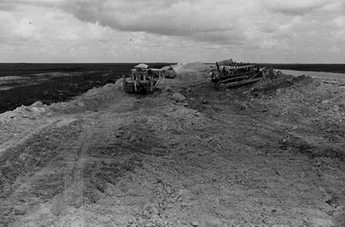
Roads opened the interior to settlement, development, and tourism, as well as speeding travel.

They became dams, impeding water flow from north to south, and boundaries separating development from wetlands from east to west.

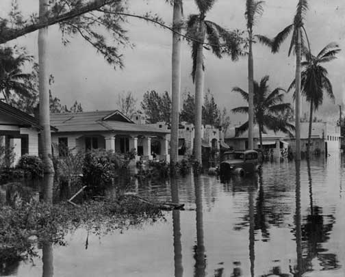
FLOOD CONTROL & WATER MANAGEMENT

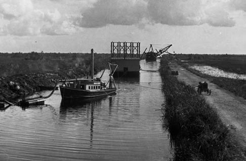
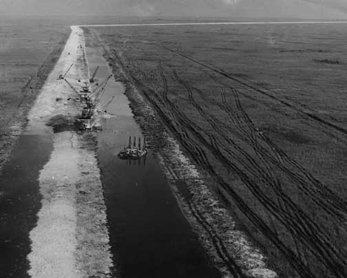
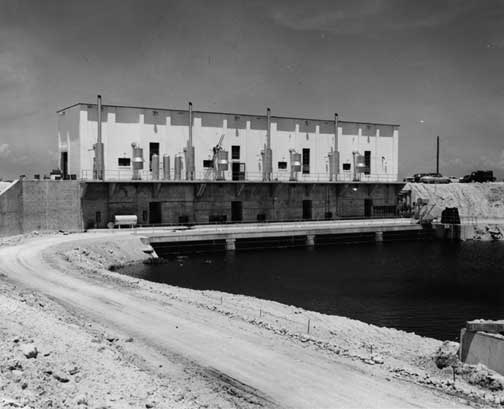
After 1928, Everglades engineering projects shifted from drainage and land reclamation to flood control.

Over the years, new canals were dug, old canals were deepened, and dikes, levees, and pumping stations were added, all to prevent flooding in urban, suburban, and agricultural areas. While these projects made it possible for coastal cities to grow and thrive, natural areas were severely affected by reduced and arbitrary water flow.

During the last quarter of the twentieth century, projects shifted once again, from flood control to water management, in order to provide for both civilization and nature.

More than 2,000 people died during the 1928 hurricane when the lands near and south of Lake Okeechobee flooded. The tragedy stimulated an interest in flood control.  Postcard, 1928. 1980-053-35

Full Image

Levee L-30 (Miami-Dade County) under construction. June 1951.  HMSF, Miami News Collection. 1989-011-5535.

Full Image

Flood control pump station S-2. 1950s.  HMSF, Miami News Collection. 1989-011-5559.

Full Image

In 1947 flooding from two hurricanes inundated western Dade and Broward counties. As a result the state established the Central and South Florida Flood Control District, now known as the South Florida Water Management District.  HMSF, Miami News Collection. 1989-011-8007.

Full Image

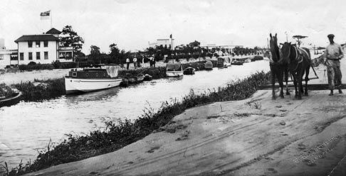
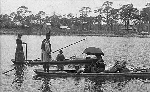
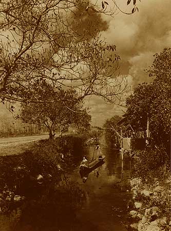
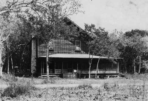
LOWER EVERGLADES SETTLEMENTS

During the 1920s, the Tropical Development Company started a city, Poinciana, on Lostman’s River in the Ten Thousand Islands. The few buildings and improvements that the company built were destroyed during the 1926 hurricane.  ca. 1925.

Full Image

Chokoloskee, a small island, was first settled in 1874. Its most famous resident, Ted Smallwood, settled there in 1897, and ran a store for decades. A causeway finally connected it to Everglades City and civilization in 1955.  This view: Smallwood Store, 1960s.

Full Image

Squatters started settling Everglade (now Everglades City) in the 1860s and 1870s. In 1892, George Storter, Jr., started a store, which became a center of activity for the settlement. Everglades City was designated Collier County's first seat in 1923. Within a few years, a road onnected it to Tamiami Trail.  This view: Everglades City, 1911. Left: Storter house, store and post office. Center: Cruise boat with shark hanging from bow. Right: shed for storing alligator hides and gasoline.

Full Image

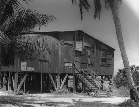
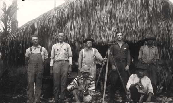
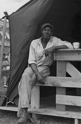
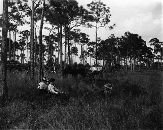
In the lower Everglades, homesteads and settlements grew on bays and navigable creeks. The Everglades' first white settlers lived in remote places, surrounded by wilderness.

There, frontier men and women made a living through subsistence farming, hunting, fishing, trading posts, and charcoal making.

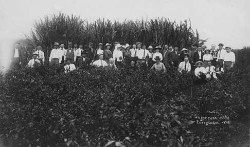
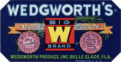
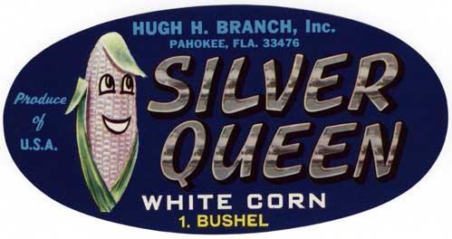
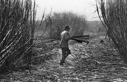
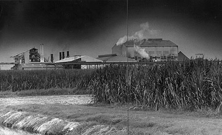
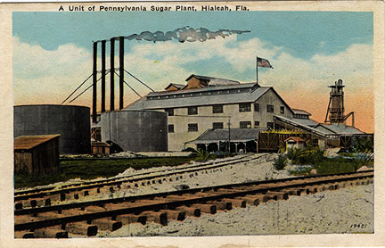
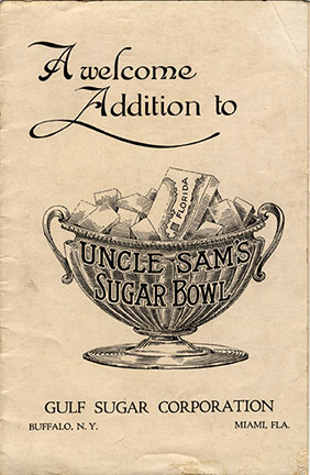
SUGAR IN THE EVERGLADES

At first, vegetable and sugar farms in the Everglades struggled and failed. Farmers needed more land, reliable labor, and knowledge of growing conditions in reclaimed muck.

By mid-century, the small farms of the 1910s had been consolidated into large plantations in the Upper Everglades, and farmers had acquired the knowledge and labor to successfully farm crops.

Beginning in the 1960s, growers concentrated upon sugar, and increased the number of acres under cultivation. The water table was lowered to stimulate sugarcane growth, and the nutrient-laden water that flowed south from the fields altered the vegetation in the Everglades. In many places, for example, cattails replaced sawgrass.

Black workers contributed to the farms’ success. At first, African American seasonal laborers worked the fields. During World War II and until 1995, Blacks from the Bahamas and the Caribbean provided migrant labor.  HMSF, Miami News Collection. 1995-277-9154.

Full Image

In 1961, Cuba stopped exporting sugar to the U.S., creating the opportunity for large sugar plantations to thrive south of the Lake. Pastures and vegetable fields were converted to sugarcane.  HMSF, Miami News Collection. 1995-227-9455.

Full Image

In the 1920s, the Pennsylvania Sugar Company established a sugar plantation and factory at Pennsuco, near present-day Miami Lakes and Hialeah. It closed within a few years.  1995-436-75

Full Image

Pamphlet promoting sugar cultivation in Florida. 1921.

Full Image

Black workers contributed to the farms' success. At first, African American seasonal laborers worked the fields. During World War II and until 1995, Blacks from the Bahamas and the Caribbean provided migrant labor.  This view: Bahamian worker, ca. 1943.  1993-171-9

Full Image

Pamphlet promoting sugar cultivation in Florida. 1921.

Full Image

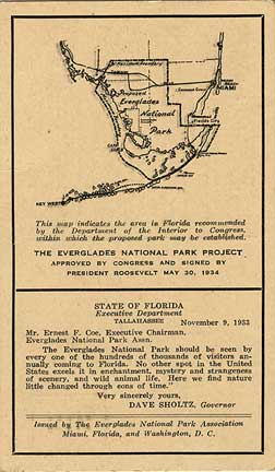
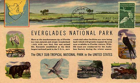
EVERGLADES NATIONAL PARK

In 1930 an official delegation toured the Everglades and recommended to Congress that a national park be created. Their visit and their report helped convince Congress that the Everglades should be preserved.  The delegation included Ernest F. Coe, chairman Tropic Everglades Park Association (far right); Congressman Ruth Bryan Owen of Florida (fourth from right); and Dr. David Fairchild, president Tropic Everglades Park Association (fifth from right).  Photo by Gleason Waite Romer.

Full Image

Park dedication program

Full Image

Park ranger and visitors, 1950s.  X-368-7

Full Image

1999-309-8

Full Image

Coinciding with the opening of the national park in 1947, Marjory Stoneman Douglas published her book on the Everglades. The book became a classic, and helped many people develop a love for the region.

Full Image

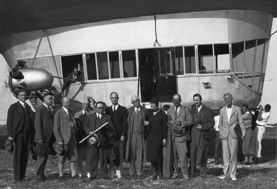
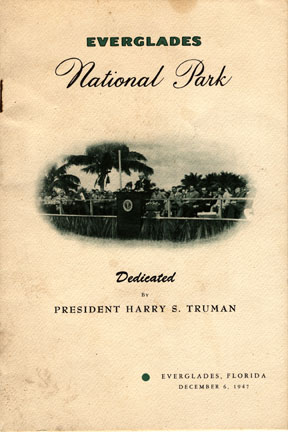
During the 1920s and 1930s, Ernest F. Coe led the campaign to create a national park in the Everglades.

Congress passed an act to create the park in 1934, but the Depression and World War II delayed its founding until 1947. Since then, Everglades National Park has expanded it boundaries to include Chekika State Park in South Dade and other land in the East Everglades.
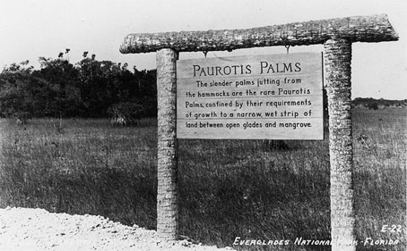
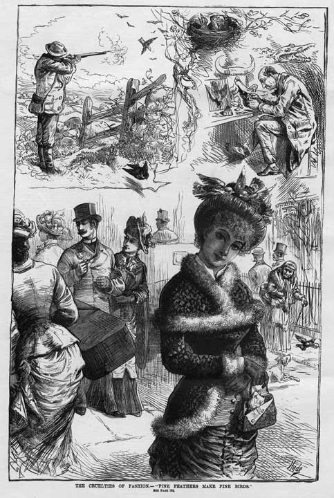
ENDANGERED SPECIES

As more and more people moved into South Florida, the diversity of plants, animals, and habitats declined. Hunting, fishing, collecting, changing water flow, and encroaching development all contributed to the decline.

Settlers and writers thought the Florida Panther was a dangerous animal that should be shot on sight. A century later, it had become a

Full Image

Collectors removed so many palms, orchids, and Liguus tree snails that they became endangered or extinct. Some collectors would burn a hammock after gathering all the Liguus or orchids, to ensure that their collections contained the only varieties that exist. This practice is now illegal.  Plate from “The Florida Tree Snails of the Genus Liguus,” by Charles Torrey Simpson. Proceedings of the United States National Museum, v. 73, no. 20 (1929).

Full Image

Feathers adorned fashionable late-nineteenth century hats—so many that the birds who contributed the feathers became endangered species. Plume hunters in the Everglades shot out rookeries and slaughtered egrets, herons and spoonbills. Audubon warden Guy Bradley became the Everglades’ first martyr when he was murdered at the Cuthbert Lake Rookery (near Flamingo) in 1905. Changing fashions and national laws ended the slaughter in the 1910s.  This view: “The cruelties of fashion : fine feathers make fine birds.” From Frank Leslie's Illustrated Newspaper (November 10, 1883), p. 184.

Full Image

BIG CYPRESS NATIONAL PRESERVE

Construction of the Jetport, a new airport halfway across Tamiami Trail, stopped in 1970. Big Cypress National Preserve was founded shortly thereafter, and it preserves lands the Jetport would have destroyed.  1981-099-13

Full Image

The original Everglades National Park boundaries included parts of Big Cypress Swamp.  1934 postcard.

Full Image

Hunters riding swamp buggy. 1953.  HMSF, Miami News Collection. 1989-011-13388

Full Image

The 1930s plans for Everglades National Park included most of Big Cypress Swamp, but for political and financial reasons, it was excluded from the 1947 park boundaries.

During the 1960s, another campaign for a national park began, and led to the creation of Big Cypress National Preserve in 1974. It differs from a national park in that some economic and recreational activities are permitted, such as oil exploration and hunting.
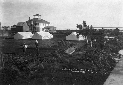
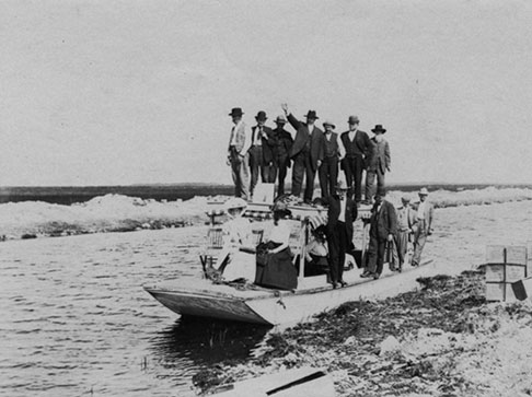
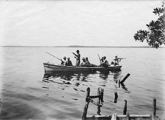
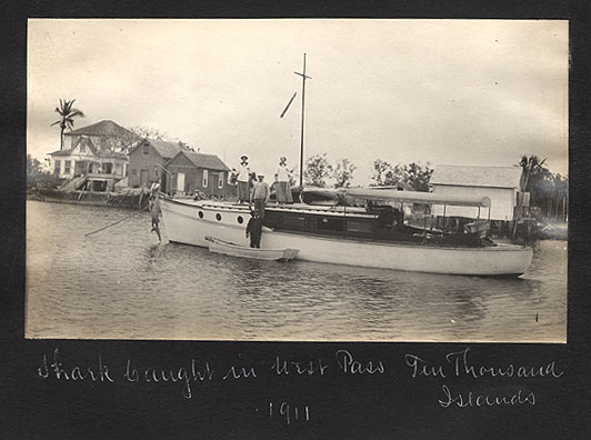
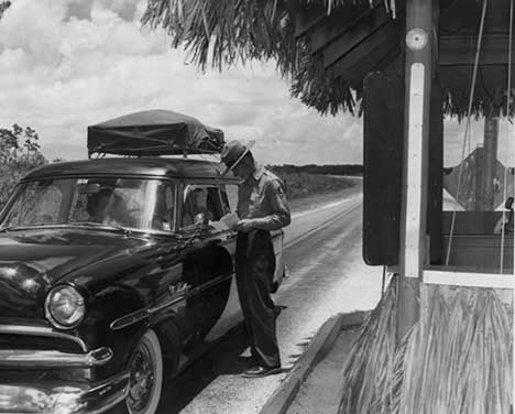
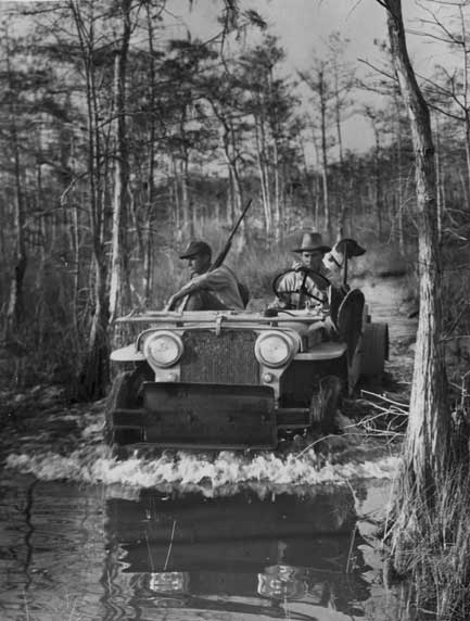
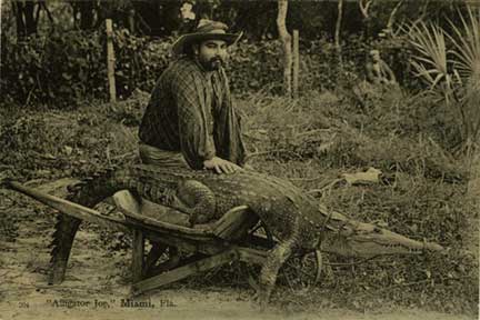
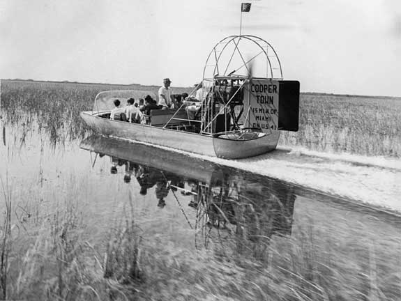
EVERGLADES TOURISM

People began visiting the Everglades for pleasure during the late 1800s. Most traveled on small sailboats to coastal settlements, such as Coconut Grove and Chokoloskee.

Steamboats and other, smaller boats carried sightseers up canals and "improved" waterways. As roads were built and improved, more people ventured inland.

Attractions packaged the Everglades experience for tourists. During the 1890s, Alligator Joe ran the first alligator farms in West Palm Beach and Miami. In this postcard, he is posing with a crocodile.  1984-100-24

Full Image

Cooper Town airboat ride, ca. 1960.  HMSF, Miami News Collection. 1989-011-1747

Full Image

Naturalist Charles Brookfield leading a tour of the Everglades. 1947.  HMSF, Miami News Collection. 1989-011-19404.

Full Image

Coconut Grove tourists resting in pine woods. ca. 1890.  HMSF, Ralph Munroe Collection. 1A.

Full Image

Indian villages in Miami (Musa Isle and Coppinger's) featured alligator wrestling, glimpses of everyday life, and souvenirs.  March 4, 1924.  Photo by Claude Matlack. 93-30.

Full Image

EVERGLADES RESTORATION

During the past century, humans changed South Florida's environment, making it possible for the cities along the coast and the farms south of Lake Okeechobee to exist. The price, however, has been high: the region's water supply and the Everglades are both in jeopardy.

To repair the mistakes of the past, the state and federal governments have embarked upon 68 restoration projects that will cost at least $8 billion over more than 20 years. The governments have stated that Everglades water needs will be given priority over development, but the needs of cities and agriculture will always exert pressure upon decision-makers. This chapter in Everglades history remains to be written.

1947 postcard.

Full Image

UPPER EVERGLADES SETTLEMENTS

Upper Everglades towns were established by Lake Okeechobee and canals, mostly during and after drainage and land reclamation projects.

Work carried out there related to drainage and land reclamation, truck farming, and, as years went by, sugar growing.

Moore Haven was founded in 1915, at the Caloosahatchee Canal entrance to Lake Okeechobee.  1998-266-1

Full Image

In 1921-1922 the Atlantic Coast Line Railroad was extended from Moore Haven to Sand Point, on Lake Okeechobee. For the occasion, the tiny Sand Point community was named Clewiston, after A. C. Clewis, who had financed the railway construction.  HMSF, Claude Matlack Collection. 74-31.

Full Image

Lake Harbor originated in 1912, when the Okeechobee Fruitlands Company built the Bolles Hotel to house potential land purchasers. Until 1931, the town was named Ritta, a misspelling of Rita, meaning small and lovely.  1976-089-9

Full Image

Until 1921 Belle Glade was called the Hillsborough Canal Settlement. Located on the southeast shore of Lake Okeechobee, some of the best farmland surrounded it.

Full Image

Sign Up for Newsletter!

Learn more about upcoming events & programs through our e-mail newsletters.

Sign up!

Sign Up for Newsletter!

Learn more about upcoming events & programs through our e-mail newsletters.

* indicates required

Address

HistoryMiami
101 West Flagler Street
Miami, FL 33130
Parking directions

Contact

305-375-1492
e.info@historymiami.org

Connect with Us

Affiliates

© HistoryMiami. All rights reserved.

Search The HistoryMiami Website